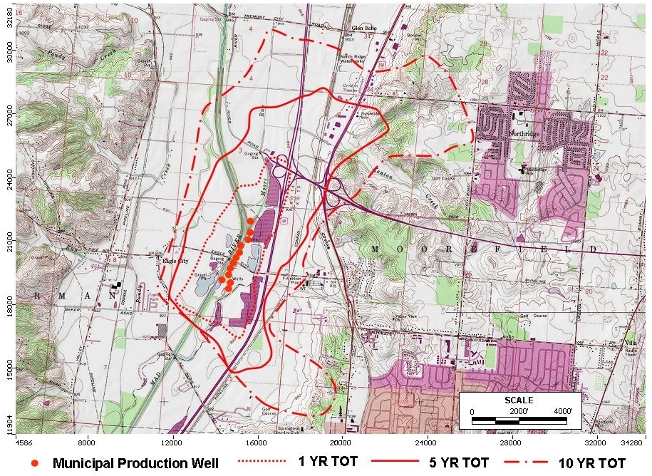
The City of Springfield operates a large 12 MGD production well field in support of municipal water supply along the Mad River. The well field is managed with Well Head Protection Area (WHPA) of 1-year and 5-year time of travel boundaries developed by the Ohio EPA in the early 1990s. Recent developments in terms of industrial/commercial activity within the buried valley aquifer system of the Mad River has concerned the City to investigate potential impacts to the well field from activities inside and outside of the WHPA boundaries including road salt storage and gravel pit mining.
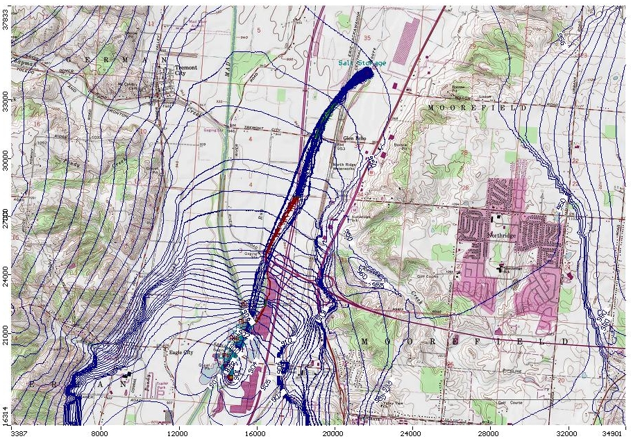
Terran prepared a multiple-layered MODFLOW groundwater flow model to simulate the Mad River buried valley aquifer system for the purpose of evaluating the 1-year, 5-year and 10-year Time-of-Travel boundaries (as requested by client), and to simulate the potential impacts for gravel mining next to the well field, and for potential of road salt storage at a facility upgradient of the well field to be captured by the well field (using particle tracking simulations only). The model domain is now used by the City in its efforts to manage potential threats to the City’s well field.

WHPA Time-of-Travel boundaries as developed using MODFLOW and MODPATH modeling for Well Field in Mad River Buried Valley Aquifer.

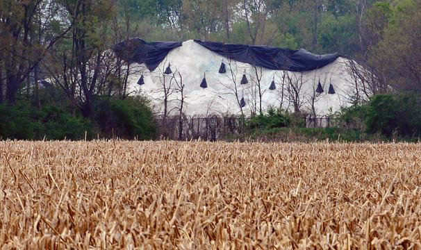
Road salt storage facility in study area (now closed)

Model scenario using particle-tracking to evaluate potential for advective groundwater flow from former salt storage facility to well field (note: not a fate & transport evaluation).
Terran can help you manage your Well field groundwater resources with modeling and other tools and techniques. Please contact us at (937) 320-3601 to discuss your project if we can be of service.
More examples of Terran Corporation’s modeling projects:
- Arsenic and Chloride Fate and Transport Modeling for Water Supply Permitting.
- Assessment of Aquifer Sustained Yield Potential.
- Hydrogeologic Evaluation for Wellfield Development.
- Aquifer Evaluation and Ground Water Modeling for a New Water Supply.
- Substructure Flooding Potential.
- Construction Dewatering Study.
- Computer Modeling of Phytoremediation for Corrective Action Evaluation.
