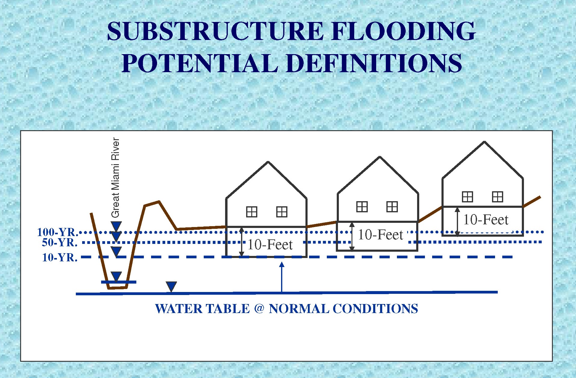
The Miami Conservancy District (MCD) was originally formed to control and manage flood waters as a result of the March 1913 flood. Since then, the MCD mission objectives and goals include protecting lives, property, and economic vitality within the Great Miami River Watershed through an integrated and balanced system that provides unfailing flood protection, preserves water resources, and promotes enjoyment of the Great Miami River watershed. Since the 1970s, groundwater levels in the Great Miami River aquifer has risen, primarily due to declines in groundwater pumping associated with industry over the years. As a result, incidents of basement flooding have increased in areas along the Great Miami River water shed. This study was conducted by Terran Corporation for the MCD to identify areas with potential for substructure flooding based on flood recurrence intervals of 10-years, 50-years and 100-years for high water events along the Great Miami River in the City of Dayton, Ohio.

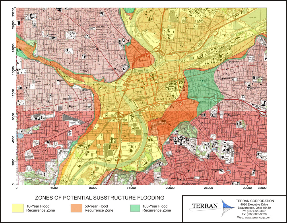
MODFLOW was used to simulate the Great Miami River as a function of the 10-year, 50-year and 100-year events to model aquifer water levels in response to the flood events along the river (all water contained within the MCD levees and dams). A regional model of the Dayton, Ohio area was prepared to simulate the Great Miami River Buried Valley Aquifer and its groundwater-surface water interactions. Results of the study identified areas along the Great Miami River that may be susceptible to sub-structure or basement flooding during these events.

Map of Zones of Potential Substructure Flooding developed by MODFLOW modeling efforts of Terran Corporation for MCD.
Terran loves to work on unusual types of model projects. Please contact us at (937) 320-3601 to discuss your project if you think ground water modeling might help.
More examples of Terran Corporation’s modeling projects:
- Arsenic and Chloride Fate and Transport Modeling for Water Supply Permitting.
- Assessment of Aquifer Sustained Yield Potential.
- Hydrogeologic Evaluation for Wellfield Development.
- Aquifer Evaluation and Ground Water Modeling for a New Water Supply.
- Well Head Protection Area Study.
- Construction Dewatering Study.
- Computer Modeling of Phytoremediation for Corrective Action Evaluation.
